
Mt Rufus Cynthia Bay Walk
- September 16, 2026
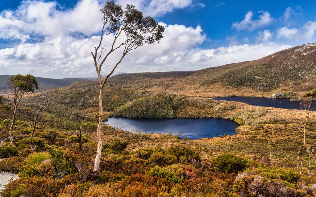
A challenging full-day circuit from Cynthia Bay to the summit of Mount Rufus, with wide views over Lake St Clair.


The Echo Point Ferry & Walk is one of the most memorable ways to experience Lake St Clair, combining a scenic ferry journey across Australia’s deepest lake with an 11-kilometre walk back through beautiful rainforest along the lakeshore. Rather than walking out and back along the same track, the adventure begins at Cynthia Bay, where you board the Lake St Clair passenger ferry for the approximately 20-minute journey to Echo Point. After stepping ashore at the tiny Echo Point jetty, the ferry departs and the real adventure begins – an atmospheric walk through ancient myrtle-beech rainforest following the western shoreline of Lake St Clair back to Cynthia Bay. With rainforest, secluded beaches, mountain views and sections of the famous Overland Track, this is one of the best half-day walks in the Lake St Clair area.
Location: Lake St Clair, Cradle Mountain–Lake St Clair National Park, Central Highlands Tasmania
Distance: Approximately 11 km one way
Time: Approximately 3–4 hours walking, plus ferry journey
Difficulty: Grade 3 – Moderate
Track Type: Ferry out, one-way walk back to Cynthia Bay
Ferry: Approximately 20 minutes from Cynthia Bay to Echo Point – bookings essential
Track Surface: Formed bushwalking track through rainforest with tree roots, rocks, muddy sections and occasional short climbs
Best Time: Late spring through autumn, although the walk can be undertaken year-round when conditions permit
Half the fun of this walk is getting to the trailhead. The adventure starts from the jetty at Cynthia Bay, near the Lake St Clair Visitor Centre. From here, the passenger ferry heads north across Lake St Clair towards Echo Point. The approximately 20-minute ferry journey provides spectacular views of the mountains surrounding the lake and gives walkers a completely different perspective of this glacial landscape. Mountains rise steeply above the water, while the densely forested shoreline provides a glimpse of the wilderness you’ll soon be walking through. The ferry eventually pulls alongside the small jetty at Echo Point. Once you step ashore, the only way back is on foot – unless you’ve made alternative ferry arrangements.
Echo Point is a wonderfully secluded location approximately three-quarters of the way up Lake St Clair. A tiny jetty extends into the lake beside a small clearing surrounded by dense rainforest. Nearby is the rustic Echo Point Hut, part of the Overland Track infrastructure and a reminder that you’re now walking along the final section of Tasmania’s famous multi-day wilderness track. Before beginning the walk, take a few minutes to enjoy the shoreline. Across the water rises the distinctive profile of Mount Ida, which was left standing between the enormous glaciers that carved the surrounding landscape.
From Echo Point, follow the clearly defined track south towards Cynthia Bay. Much of the route stays relatively close to the western shoreline of Lake St Clair, although dense forest often separates the track from the water. The walking is wonderfully atmospheric. Ancient myrtle-beech trees tower above the track while mosses, fungi and ferns cover fallen logs and the forest floor. In places, the rainforest canopy creates a cool green tunnel that feels remarkably remote. Occasional openings provide views across Lake St Clair towards the mountains on the opposite shore.
One of the highlights of the Echo Point walk is the magnificent cool-temperate rainforest. Myrtle-beech dominates much of the forest, accompanied by sassafras, celery-top pine, leatherwood and an abundance of ferns and mosses. After rain, the forest becomes particularly atmospheric, with moss-covered trunks, dripping foliage and small streams crossing the track. The downside is that the track can also become muddy, slippery and covered with wet tree roots, so sturdy footwear is strongly recommended.
Throughout the walk you’re never far from Lake St Clair – leeawuleena. Carved by glaciers during successive ice ages, Lake St Clair is the deepest lake in Australia and reaches a maximum depth of around 167 metres. The Aboriginal name leeawuleena is generally translated as “sleeping water”, an especially appropriate description on calm days when the surrounding mountains and forest are reflected across the surface. Several sections of the walk provide access to the shoreline, making excellent places to stop for a rest or lunch.
One of the most distinctive mountains visible from Echo Point is Mount Ida. The sharp peak rises dramatically from the eastern side of Lake St Clair and provides an impressive backdrop during the early stages of the walk. The mountain is particularly striking when viewed across calm water from the Echo Point jetty.
The Echo Point route follows part of the final section of Tasmania’s legendary Overland Track. Walkers completing the full Overland Track arrive at Narcissus at the northern end of Lake St Clair. Many catch the ferry from Narcissus to Cynthia Bay, while others continue walking along the western shoreline. Echo Point lies approximately 5 kilometres south of Narcissus, so day walkers joining the track here get to experience the final 11 kilometres of the Overland Track without undertaking the full multi-day journey.
The Echo Point Walk is classified Grade 3.
There are no major mountain climbs, but the 11-kilometre distance and sometimes rough rainforest track make it a genuine half-day bushwalk rather than an easy lakeside stroll.
Expect:
Some bushwalking experience and reasonable fitness are recommended.
The walk begins from the Lake St Clair Visitor Centre at Cynthia Bay. From Derwent Bridge on the Lyell Highway, turn onto Lake St Clair Road (C193) and follow it for approximately 5.5 kilometres to Cynthia Bay. Parking is available near the visitor centre. From here, walk to the ferry departure point and board the pre-booked ferry to Echo Point.
The passenger ferry operates across Lake St Clair between Cynthia Bay, Echo Point and Narcissus. Bookings are essential for walkers planning to use the ferry to reach Echo Point. The service is privately operated and subject to weather conditions, passenger numbers and operational requirements, so don’t simply arrive expecting a departure to be available. Check the current timetable, fares and Echo Point drop-off arrangements when making your booking.
Most visitor facilities are located at Cynthia Bay.
At Echo Point facilities are extremely limited, although a bush toilet is available.
Lake St Clair has an excellent selection of walks ranging from easy lakeside strolls to challenging full-day mountain walks.
The Lake St Clair Short Walks start from Cynthia Bay and can be combined into a circuit of approximately 4.7 km. Options include the Watersmeet Track, Platypus Bay and the Aboriginal cultural walk, making these an excellent choice for visitors who don’t have time for Echo Point. Frankland Beaches Walk. The Frankland Beaches Walk is an easier lakeside option following the shoreline through glacial moraine country.
The walk is approximately 6 km return, takes around 2 hours and is graded Grade 2.
The Shadow Lake Walk is a longer circuit through rainforest, highland eucalypt forest and subalpine vegetation. At approximately 13 km and 4–5 hours, it provides a more challenging alternative for walkers wanting to explore the country surrounding Lake St Clair.
The Mount Rufus Circuit is one of the area’s major full-day walks.
The approximately 19 km, 7-hour Grade 4 circuit climbs into exposed alpine country and rewards experienced walkers with outstanding views across Lake St Clair and the surrounding mountains.
The Overland Track is Tasmania’s best-known multi-day bushwalk, crossing the heart of Cradle Mountain–Lake St Clair National Park before reaching the northern end of Lake St Clair. Echo Point forms part of the final lakeside section of this famous wilderness journey.
The Echo Point Ferry & Walk offers something few Tasmanian day walks can match – the adventure starts before you even put your boots on the track. A ferry ride across Lake St Clair carries you deep into the national park before dropping you at a tiny wilderness jetty surrounded by mountains and rainforest. From there, the 11-kilometre journey back to Cynthia Bay follows the lakeshore through beautiful old rainforest, secluded beaches and part of the legendary Overland Track. For walkers wanting to experience the wilderness of Cradle Mountain–Lake St Clair National Park without committing to an overnight walk, Echo Point is one of the best half-day adventures in Tasmania.
A challenging full-day circuit from Cynthia Bay to the summit of Mount Rufus, with wide views over Lake St Clair.

Three short, easy walks from Cynthia Bay exploring Aboriginal culture, rivers and platypus habitat at Lake St Clair.

A quiet lakeside walk from Cynthia Bay to a string of secluded beaches along Lake St Clair's old glacial moraines.

A half-day alpine circuit from Cynthia Bay climbing through rainforest and moorland to Shadow Lake beneath Mount Hugel.


Tasmania's most famous walk, the iconic multi-day Overland Track from Cradle Mountain to Lake St Clair.

